Redrawing Reality: How a Property Line Survey Brings Legal Accuracy to Light
Misunderstood land boundaries have caused more legal disputes between neighbors than most realize. A property line survey offers more than boundary markers—it draws a legal boundary line grounded in accuracy and records. This service ensures landowners, buyers, and builders have a clear understanding of the physical limits of their property, backed by certified measurements and historical data.
Why the Boundaries You Assume May Be Wrong
Fences, trees, and even driveways often create a misleading picture of ownership. These features rarely follow the legally recorded lines. Without a proper survey, you might unknowingly build outside your lot or leave part of your land underused. Many homeowners don’t question these visual cues until they face legal notices or construction delays. Getting your property surveyed by professionals clears up assumptions and provides written, verifiable proof of what’s yours.
How a Survey Reduces Legal Risks
A property line survey holds weight in courts, contracts, and construction permits. It ensures compliance with zoning laws and helps avoid disputes with neighbors. Whether installing a new structure or selling your home, a certified surveyor’s report gives you a documented reference that can prevent costly legal battles. Skipping this step might save a bit of money upfront, but it can cost significantly more in repairs, redesigns, or legal fees.
The Hidden Layers Behind Every Survey
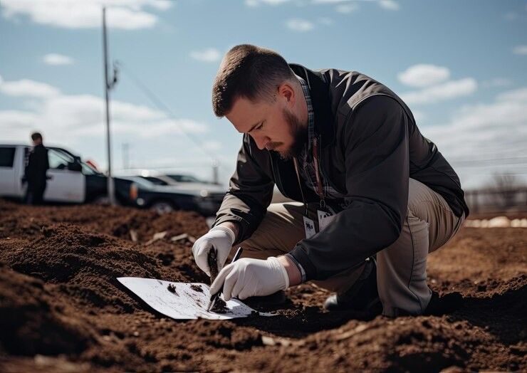
This isn’t just about drawing lines on a map. Surveyors research historical land records, analyze plats, use modern equipment for measurement, and cross-check data to confirm each inch of the property. They account for natural features, old deeds, and public records to make sure nothing is missed. It’s a precise process that blends fieldwork and record verification, giving you results that stand up to scrutiny.
Surveying professionals often revisit outdated assumptions about property limits. In areas with aging infrastructure or vague plot descriptions, a current survey replaces assumptions with confirmed data. This helps bring older records in line with modern requirements and allows for confident planning.
Property Disputes Start with Uncertainty
Arguments between neighbors often stem from unclear property lines. These disputes can delay construction projects, halt sales, or result in lawsuits. A survey helps settle these issues before they escalate. It’s easier to agree on facts than opinions. When both parties review a professional survey report, discussions become constructive rather than confrontational.
Legal clarity also supports smoother negotiations during property transfers or shared projects like fencing and driveways. Clear data reduces tension and speeds up agreement, whether between neighbors or contractors.
Making Construction Easier and Safer
Builders rely on accurate boundaries to avoid code violations or foundation errors. Even a small mistake in placement can trigger fines or demolition orders. With the help of a certified property line survey, contractors can work confidently, knowing that every stake in the ground is legally placed. This protects both the contractor and the homeowner from potential setbacks.
A well-documented survey also supports inspection approval. Local regulators often request proof of property lines during permit reviews. Submitting an up-to-date survey can help your application move forward faster.
Saving Time and Money on Future Plans
Planning for a home addition or a new fence? A survey lays the groundwork for smooth approvals and clear design plans. It eliminates the risk of building on restricted zones or outside the actual lot. With this clarity, project timelines stay on track, and expenses remain predictable.
Your Land, Clearly Defined
Each parcel of land carries its own history. Without accurate documentation, ownership becomes uncertain. A property line survey turns that uncertainty into verified facts. It protects your investment and supports future planning. Whether you’re refinancing, building, or preparing to sell, having that clarity is a smart move.
End Misunderstandings Before They Begin
Many property disagreements are avoidable. A survey provides the tools to prevent confusion and give peace of mind. It also strengthens the property’s value by offering clear documentation buyers and lenders can trust.
Final Say:
At RealMapInfo LLC, our expert surveyors bring clarity to property ownership through dependable, professional surveys. Whether you're starting a project, resolving a dispute, or simply want peace of mind, our team ensures that every boundary is clearly marked and legally sound. From lot verification to full-scale residential land survey services, we deliver results that meet legal, financial, and construction needs with care and precision.
Don’t leave your land ownership to chance. Contact RealMapInfo LLC today and get a trusted survey that brings legal clarity and real confidence to your property decisions.
FAQs:
1. What is a property line survey?
A property line survey marks the legal boundaries of a land parcel using certified measurement and records.
2. Why should I get my property surveyed?
It prevents boundary disputes, supports legal compliance, and ensures accurate placement for construction.
3. How long does a typical survey take?
Most residential surveys take a few days, depending on the property size and record availability.
4. Is a property line survey legally binding?
Yes, it’s recognized in legal settings, contract reviews, permit approvals, and dispute resolution.
5. Can I build without a property survey?
It’s risky. Without a survey, you may build outside your lot and face legal or financial penalties.


Share On: