How Licensed Surveyors Survey Property Lines with Accuracy and Authority
To survey property lines correctly, licensed professionals begin with legal documentation. They pull deeds, plats, and easements from official records. This ensures the measurements recorded in the field align with legal descriptions. Using certified data builds a trustworthy map that clients can rely on before any decisions are made.
Reading the Records
Surveyors must interpret old maps, government filings, and title documents. They look for boundary descriptions that mention landmarks, coordinates, or angles. These details guide fieldwork and help confirm whether any boundary marker has moved or been removed. This careful review forms the foundation of accurate measurement.
The process often reveals layers of information—original lines, adjusted lots, or utility placements. By understanding how each feature connects across documents, surveyors build a clear, reliable narrative of the land’s legal shape. This also helps spot red flags, like overlapping claims or missing data, before they become bigger issues.
Field Checks and Marker Verification
After reviewing records, surveyors head to the site with equipment like GPS tools, total stations, and levels. They locate boundary markers—pins, monuments, or old pipes—and check their positions against digital plans. Any discrepancies are noted and resolved through on-site triangulation and measurement confirmation. This step ties physical markers to legal definitions.
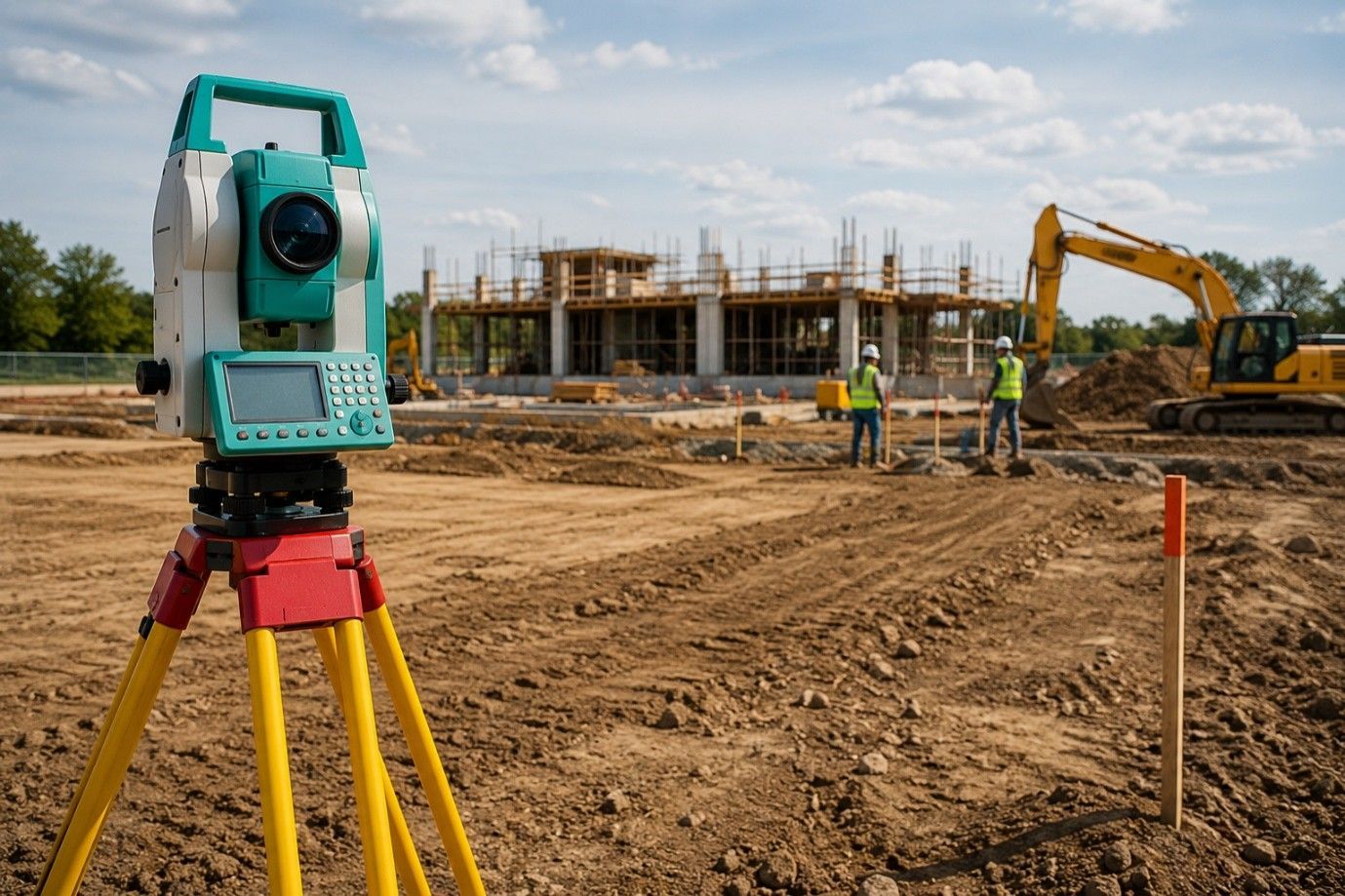
Using Modern Technology
Licensed surveyors bring advanced tools to the field. GPS systems provide centimeter-level accuracy, even under tree canopy or near structures. Total stations measure angles and distances to fixed points. Laser scanners capture 3D views of terrain. That combination ensures that survey data is precise and repeatable, with clear records saved in digital files.
These tools help cover larger areas in less time while improving data quality. Surveyors also use mapping software to overlay data onto parcel records. Clients benefit from visual clarity and dependable results that hold up for legal, engineering, or construction needs.
Resolving Conflicts on the Ground
Sometimes markers conflict with landmarks or fences. In those cases, surveyors consult record evidence and apply boundary law principles. They produce a report explaining how each measurement aligns with both field conditions and legal documents. This provides a basis for solutions and helps guide local officials or boundary meetings when disputes occur.
An experienced surveyor acts as a neutral authority during disagreements. Their documented findings can guide neighbor discussions or support legal clarity. Transparency during the survey process helps reduce tensions and avoids unnecessary litigation.
Documenting Every Detail
Every survey is supported by a clear, formal report. This includes maps, coordinates, lists of findings, and notes on any anomalies. Reports meet state licensing requirements and include the surveyor's seal. That makes them acceptable for use in court, land transfers, or permit applications.
These documents may also include topographic information or improvement locations when requested. Licensed surveys often become part of long-term records, helping future professionals assess land history with confidence.
Ensuring Local Compliance
Local rules can affect surveys. For instance, setback rules, shared access agreements, and easements must be respected. Licensed surveyors know to check code requirements and record any restrictions. Their work ensures that clients avoid penalties or enforcement actions and can use their land as intended.
Working knowledge of municipal codes and permitting standards makes their input valuable for developers, homeowners, and planners. This preparation helps avoid delays or rework once a project starts.
Certification and Legal Standing
Only licensed professionals can certify a survey. That certification gives it legal weight. A certified report can be submitted for permits or used to settle disputes. It reassures property owners, buyers, lenders, and regulators that the results are reliable.
Having a licensed signature also protects property rights and financial investments. It proves the data was collected using correct methodology and stands up under review.
Communicating with Confidence
Once measurements are complete, surveyors walk clients through the findings. They highlight how markers were found or reset, what might shift property use, and any next steps needed for improvements. That keeps clients informed and ready to act if issues arise.
Clear communication also helps property owners plan better—whether they’re building, selling, or resolving unclear lot lines.
Supporting Construction and Development
Accurate boundary data is essential before adding structures or landscaping. Developers and builders rely on these results to draft site plans, meet permit conditions, and avoid setbacks violations. Licensed surveys reduce delays by ensuring all work begins on correct lines.
Even small projects benefit from clear limits, preventing waste and compliance issues.
Adapting to Changing Conditions
Survey results may need updates later. Natural movement, nearby construction, or land changes can shift markers. Licensed professionals provide future verifications or re-surveys to keep data current. That ongoing care maintains legal clarity for property owners.
Surveys aren’t one-time events. Professional monitoring gives property owners peace of mind and long-term certainty.
Final Look:
Boundaries become clear only when measured, confirmed, and documented by licensed experts. At RealMapInfo LLC, our team handles every step with care—from records review to shed permit plot plan preparation. We ensure legal accuracy with no guesswork.
Confirm your property lines with a trusted survey. Contact RealMapInfo LLC today for a licensed survey that supports your plans and brings real clarity to your land.
FAQS:
1. Why is it important to survey property lines before construction?
It ensures legal boundaries are respected, preventing disputes or permit issues before any work begins.
2. Who is qualified to survey property lines?
Only licensed land surveyors can legally survey property lines and certify accurate, official results.
3. How long does a property line survey usually take?
Most surveys take a few days, depending on land size, terrain, and complexity of the records.
4. Can property markers be missing or moved over time?
Yes, markers can shift or disappear; surveyors rely on official records and modern tools to verify them.
5. Is a new survey required for a shed permit plot plan?
Yes, most local codes require a certified survey to issue a shed permit plot plan accurately.


Share On: