Wayland’s Land Surveyor Who Sees and Maps Every Inch of Your Land Precisely
Understanding your land is the first step toward any smart decision. At RealMapInfo LLC, we help Wayland property owners remove the guesswork. Whether you're preparing for construction, resolving property lines, or working with the town’s review boards, we give you clear, accurate, and trusted data about your land. We don’t just measure lines—we provide clarity, so you feel confident with every step of your project.
Why a Land Survey in Wayland Isn't Just a Formality
Every property is different—even those next door to each other. That’s why having a licensed land surveyor in Wayland is more than just checking a box. It's how you prevent future legal or construction issues.
Without a proper survey, you may be building over a setback line, digging too close to a neighbor’s property, or even placing a structure where it shouldn't be. A land survey provides verified information, which becomes your strongest protection. Whether you’re preparing to sell, planning to build, or just want peace of mind—this is a critical step.
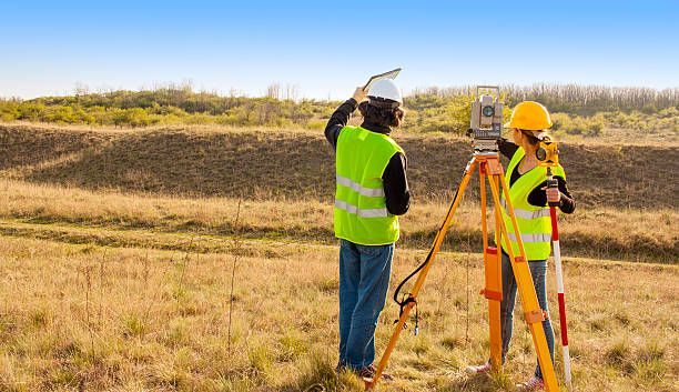
Our process is simple but detailed. We walk your lot, take exact measurements, study historical records, and create maps that make sense to both homeowners and town officials. You’ll never be left guessing what’s yours.
Trusted by Local Residents and Builders
Working with a local land surveyor like RealMapInfo LLC gives you a strong edge. We know the streets, the property histories, and the town’s expectations. That local insight saves time and helps your project move forward smoothly.
We’ve assisted homeowners planning home expansions, real estate agents preparing listings, and contractors ensuring site readiness. Having someone who knows how Wayland works—and who brings that experience into every survey—makes all the difference.
From private homes to multi-lot developments, our surveys provide clear information—so you can move ahead without delays or confusion.
Getting a Plot Plan for Building Permits? You’re in the Right Place.
If you’re applying for a building permit, you’ll likely need a building permit plot plan. This document shows your property boundaries, existing structures, and how your proposed project fits into the lot.
Our team carefully prepares this plan to match the expectations of Wayland’s building department. Whether you're putting up a new garage, expanding your home, or adding an outbuilding, we’ll give you exactly what the town requires—no confusion, no setbacks.
We prepare these plans to meet Wayland’s permit requirements. Our team works closely with your contractor or architect to ensure the details are correct—making it easier to get that permit approved.
Need to Work With the Zoning Board? Let’s Get it Right.
Town review boards want clarity. They expect you to provide a complete and accurate site picture—before they say yes. That’s where RealMapInfo LLC steps in. We provide reliable data that meets zoning standards, which makes it easier to move through approvals.
If your project requires input from the Zoning Board of Appeals, we’ll give you a land survey that supports your request. That means fewer questions, less back and forth, and better chances of approval.
We’ve worked with many homeowners on zoning variance cases, and our reports often become the deciding factor in helping them get the go-ahead.
No Guessing, No Surprises — Just Clear Answers
You shouldn’t have to guess where your land ends or whether you’re building too close to the setback line. We deliver clear results, so you know exactly what’s on your property.
RealMapInfo LLC also helps you understand easements, driveways, shared access, and other features that could impact your plans. Whether you’re buying, building, or fixing a property issue, we give you confidence.
We also address real issues like encroachments and land-use concerns. Whether it’s a misplaced fence or a disputed driveway, we’ll help bring resolution with solid documentation.
Every Inch Mapped for Peace of Mind
What sets RealMapInfo LLC apart? Precision, local insight, and a real commitment to helping people avoid land-related mistakes. From the first phone call to the final report, you’ll get answers in plain language. Whether you’re building a new deck, installing a fence, or planning a major addition—your survey matters. It protects you, your investment, and your peace of mind.
Ready to move forward with full confidence? Work with a land surveyor in Wayland who understands the details that matter. Contact RealMapInfo LLC today and get a clear picture of your land—before you make your next move.
Share On: