From Zoning to Zero Lot Lines: Weston’s Land Surveyor Knows It All
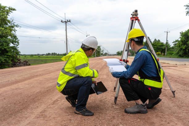
Property lines aren't something most people think about—until they have to. Whether you're planning to build, install a fence, or file for permits, knowing your land boundaries isn't just helpful—it’s essential. That’s where RealMapInfo LLC steps in as the go-to land surveyor in Weston, providing clear, precise, and reliable surveys that help prevent costly misunderstandings down the road.
A professional land survey isn’t only about lines on a map—it’s about trust, preparation, and accuracy. With RealMapInfo LLC, you get more than just coordinates; you get the confidence that everything is measured right the first time.
Clear Boundaries Begin with a Trusted Local Expert
Navigating property lines can feel overwhelming, especially if the documentation is outdated or unclear. Our team at RealMapInfo LLC understands the landscape of Weston and delivers reliable service that’s tailored to your unique needs. Whether you're dealing with a new property or a decades-old parcel, we ensure every angle is covered and every measurement is accurate.
Weston’s zoning rules require accuracy, and our experience ensures your survey aligns with local standards, offering the peace of mind you deserve. Each report is carefully reviewed to support your decisions confidently. We’re familiar with the area’s terrain, neighborhood development trends, and permit documentation process—ensuring a smooth experience from start to finish.
What a Land Survey Can Help You Avoid
Without a professional survey, assumptions can lead to conflict. From mistakenly placed fences to permit delays, cutting corners isn’t worth the risk. With RealMapInfo LLC, you avoid these issues by working with a team that handles every aspect of the process with care.
We specialize in:
- Survey boundary lines: Confirm your legal property lines before construction, fencing, or land sales.
- Land survey plot plan: A visual layout that meets town requirements for permitting and future site planning.
- Existing conditions survey: A detailed map of current site features, topography, and structures—ideal for contractors and architects.
These services aren’t just boxes to check—they’re the foundation of responsible property ownership. Getting it right early saves time, stress, and unnecessary costs later. Clear documentation also makes legal compliance easier, helping you move forward with certainty.
Personalized Service with a Local Touch
At RealMapInfo LLC, you’re not treated like a file number. We’re local to the Weston area and care about the outcome of your project as much as you do. Our surveys are tailored to your goals, whether you're subdividing land, applying for a permit, or planning a home addition.
Each property has its details and history. We take time to listen, assess your objectives, and provide a clear path forward that supports your plans. We’ve worked with homeowners, engineers, builders, and attorneys throughout Weston, always bringing a detail-focused approach that supports compliance and confidence.
Being local means we’re familiar with Weston’s layout, zoning board expectations, and the types of documentation needed to keep your project moving. We know what matters and make sure it’s included in every survey. You get relevant insight backed by real field experience—no guesswork involved.
Why Accuracy Matters More Than Ever
Zoning laws, building codes, and permit applications require precision. A misplaced line—even by inches—can lead to legal disputes or project delays. With our help, you'll have documents that meet town guidelines and reflect the true layout of your property.
RealMapInfo LLC uses industry-grade tools and updated records to give you accurate, court-defensible results. Our surveys hold up in permit offices and legal discussions because we don’t take shortcuts. Every project we complete reflects our commitment to clarity and correctness.
Your survey isn’t just paperwork—it’s protection. And with us, that protection is solid. Clear data reduces risk and protects your interests throughout every phase of your project.
Make Your Next Step the Right One
Whether you're installing a fence or planning new construction, your first move should be a call to a professional land surveyor. Weston homeowners and developers trust RealMapInfo LLC because we offer more than measurements—we deliver clarity.
No assumptions. No surprises. Just clear lines, accurate maps, and personalized service. Let us help you avoid errors that can cost time, money, and peace of mind.
Need a Survey? Let's Talk
Avoid unnecessary project delays and costly corrections. Get in touch with RealMapInfo LLC, your trusted land surveyor in Weston, and get the accurate data your project deserves. Start your property project with clarity. Contact RealMapInfo LLC today and request your survey consultation. We’re here to help—on time, every time.
Share On: