

Why Construction Projects Require Professional Land Surveys
Summary: Professional land surveys help construction projects start with reliable site information. The blog explains how survey data identifies hidden site conditions, supports digital terrain modeling, improves budgeting, guides project planning, and reduces costly risks. It also highlights why developers, investors, engineers, and builders rely on accurate land data before construction begins, helping projects move forward with greater confidence and efficiency.

Construction delays are often blamed on labor shortages, material costs, permit issues, or design revisions. However, many project setbacks begin much earlier. The real problem is often incomplete site knowledge. A building plan may look perfect on paper, yet fail once it meets actual ground conditions. This is why working with a professional
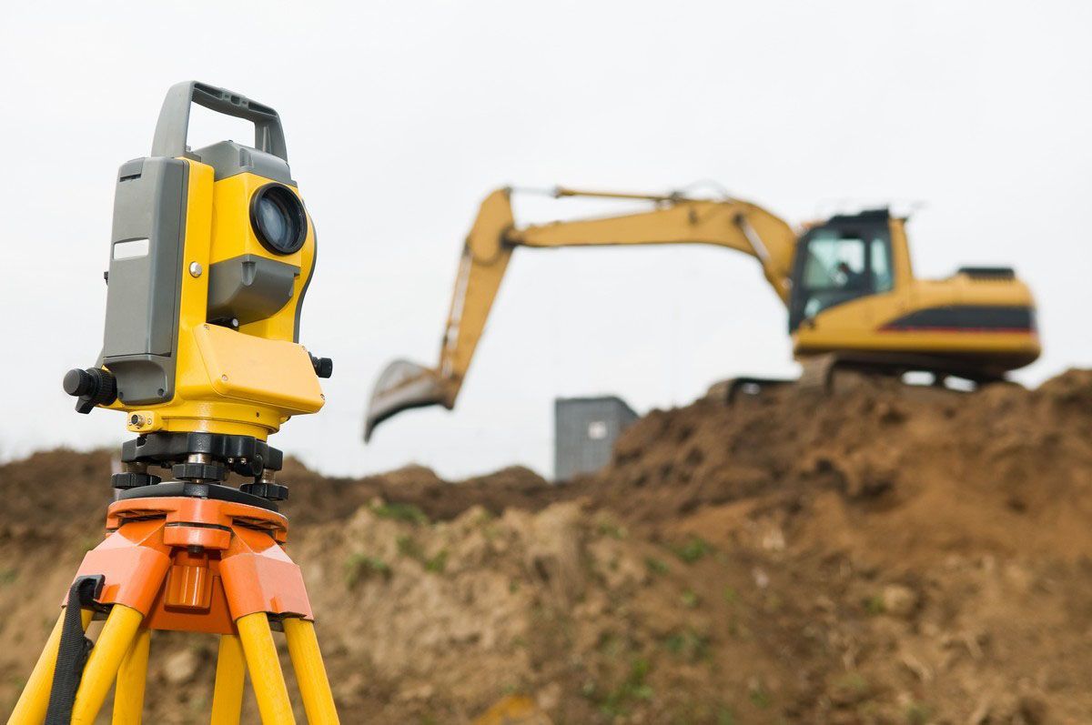
land surveyor in Grafton has become an essential step in modern development. Surveying provides the verified site intelligence needed to make informed decisions before money is committed to construction activities. It helps project owners understand the property clearly before any major work starts. Reliable information at the beginning often prevents costly mistakes later and creates a stronger path toward successful project completion.
The Most Expensive Construction Error Happens Before Groundbreaking
Many project risks appear long before excavation begins. A site may contain grade changes, undocumented improvements, utility conflicts, access limitations, or legal restrictions that are not obvious during an initial property review. Once construction starts, these issues can trigger redesign costs and schedule disruptions. Professional surveying helps reveal these conditions early, allowing project teams to make adjustments before they become expensive problems. Identifying concerns before construction begins gives owners more control over planning and helps reduce uncertainty throughout the development process.
Construction Teams No Longer Build From Drawings Alone
Modern development depends on data-rich site models rather than basic sketches. Survey information now feeds directly into engineering, architecture, drainage planning, utility coordination, and project management workflows. Accurate site intelligence creates a shared foundation that allows multiple professionals to work from the same verified information. This improves coordination and reduces misunderstandings throughout the project lifecycle. Better communication between project teams often leads to smoother execution and more predictable project outcomes.
Why Digital Terrain Models Are Changing Project Planning
One of the most valuable survey deliverables today is the digital terrain model. Instead of viewing land as a flat surface, project teams gain a detailed understanding of elevation patterns, slopes, grading requirements, and drainage behavior. These insights help determine building placement, excavation needs, and stormwater management strategies. Better terrain analysis often leads to more efficient project planning and fewer field adjustments. Having a detailed picture of the site before work begins helps teams make decisions based on facts rather than assumptions.
A Survey Can Expose Risks Hidden Beneath the Budget
Construction budgets are built around assumptions. If those assumptions are wrong, costs can increase quickly. Survey data helps identify factors that influence earthwork quantities, site accessibility, utility placement, and development feasibility. This information allows project stakeholders to create more realistic budgets based on actual site conditions rather than estimates alone. By understanding site challenges early, project owners can allocate resources more effectively and avoid unexpected expenses during construction.
Future Expansion Starts With Today's Survey Data
A construction project is rarely the final stage of a property's lifecycle. Future additions, infrastructure upgrades, parking expansions, and utility improvements often depend on information collected during the initial survey. High-quality site data becomes a long-term asset that supports future planning decisions and reduces the need to repeat investigations later. Accurate records provide ongoing value and help property owners make smarter decisions as their needs change over time.
The Rise of Data-Driven Construction Decisions
Construction projects are becoming more technology-focused every year. Survey information now supports digital workflows used across planning, design, and field operations. Teams can evaluate multiple development scenarios before construction begins, helping owners choose solutions that align with project goals. This shift has transformed surveying from a measurement service into a critical source of project intelligence. Better information leads to stronger planning and helps reduce avoidable project risks.
Why Investors and Developers Pay Close Attention to Survey Results
Before significant capital is invested in a project, stakeholders want confidence in the site itself. Survey findings provide important information about property limitations, development opportunities, legal constraints, and physical conditions. This clarity supports stronger decision-making and helps reduce uncertainty before major financial commitments are made. Reliable survey information allows investors and developers to move forward with greater confidence and a clearer understanding of project feasibility.
Closing Note:
At RealMapInfo LLC, our focus is on helping clients make better construction decisions before challenges appear. Our team provides reliable land data, site analysis, and professional surveying solutions that support smarter project planning from the earliest stages. A properly completed construction site survey does more than locate features on a property. It provides the information needed to reduce risk, improve project efficiency, support accurate planning, and create a stronger foundation for successful development. With dependable survey data, project teams can make informed decisions that help keep construction activities organized, efficient, and aligned with project goals.
Before finalizing your next construction project, speak with our surveying professionals. Accurate site intelligence today can help you avoid costly surprises tomorrow and keep your project moving forward with confidence.
FREQUENTLY ASKED QUESTIONS:
1. Why is a land survey important before construction starts?
A land survey provides accurate information about site conditions, boundaries, elevations, and constraints, helping project teams avoid mistakes, delays, and unexpected costs during development.
2. What information does a construction survey provide?
A construction survey identifies property limits, elevation details, site features, access points, and other critical information needed for planning, design, and construction activities.
3. Can a land survey reduce construction costs?
Yes. Early site analysis helps identify potential issues before work begins, reducing the risk of redesigns, delays, and unexpected expenses during the project.
4. Who benefits from professional surveying services?
Property owners, developers, contractors, engineers, architects, and investors all benefit from accurate survey data that supports informed project decisions.
5. How does survey data improve project planning?
Survey data gives project teams a clear understanding of actual site conditions, helping them design, budget, and build with greater accuracy and confidence.









Share On: