What Are the Key Responsibilities of a Professional Land Surveyor in Site Planning?
Before any official planning documents are made, a “professional land surveyor near me” plays an important role by visiting the site. They inspect the physical conditions of the land, including the slope, drainage behavior, vegetation, and existing structures. This process helps builders and engineers understand what they’re working with. Accurate site data is vital to prevent structural problems and future rework. It also helps identify any site conditions that may require special consideration during design. Surveyors also gather legal information like previous plot data, local building codes, and city or county zoning policies. This early step creates a clear path for site design, ensuring legal approval and proper building placement.
Boundary Identification: Preventing Disputes Early On
Marking the edges of the property is a key part of the surveyor's duties. They review title deeds, historical records, and legal maps to correctly define where one property ends and another begins. Using tools like GPS and total stations, they pinpoint boundary lines and mark them physically on-site. This avoids costly boundary arguments, delays, and construction problems. A properly drawn and recorded boundary layout ensures the site can move ahead without conflict.
This step is often required by permitting offices and is especially useful during property sales, loan approvals, or subdivision processes. It guarantees that all structures remain inside the legally owned land.
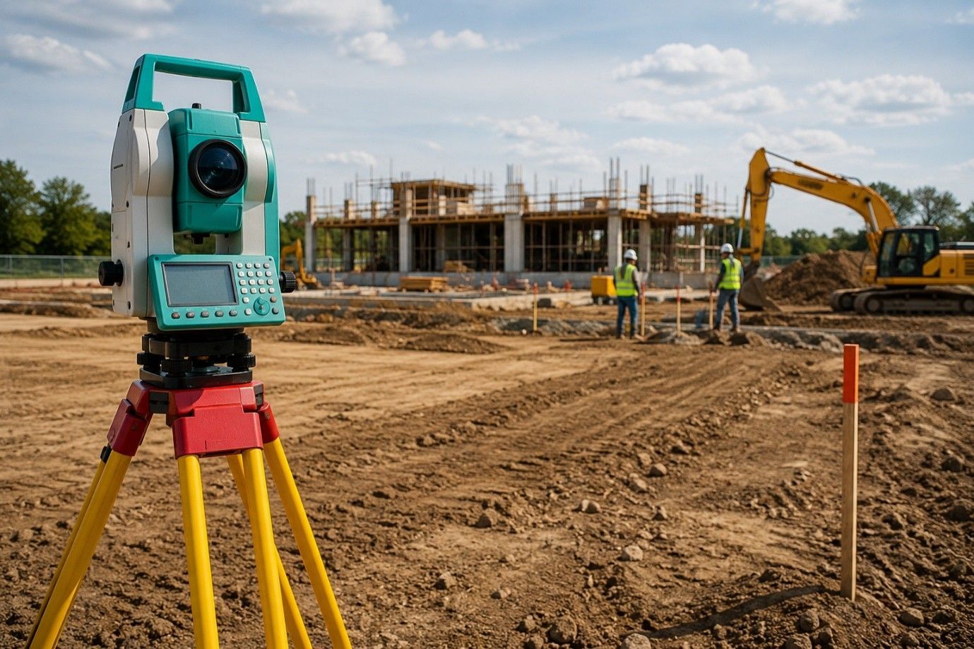
Topographic Mapping: Supporting Technical Decisions
Surveyors gather detailed information on land elevation, slope, and features like ditches, trees, or road access. This data is turned into a topographic map, which helps engineers decide where to place buildings, driveways, and water systems. Without this step, planning teams may overlook land shapes that can cause water collection or structural stress.
Topographic surveys are also important for large sites where the land surface varies. Knowing how the land slopes helps in planning water runoff and ensuring safe foundation levels. These maps also aid in grading and excavation work.
Zoning Rule Verification: Staying Within Legal Use
Each town or county enforces zoning laws, which limit how close structures can be built to property lines, how tall they can be, and what activities are allowed on the land. Surveyors help match site plans with zoning laws to make sure everything is legal.
They verify land use codes, confirm setbacks, and identify restricted areas. If the plan does not meet rules, changes are made before submission. This step saves time, avoids penalties, and improves the chance of permit approval.
Elevation Reporting: Meeting Permit and Insurance Needs
Surveyors measure land height and structure elevation to support drainage planning and flood safety. For areas near water or with past drainage problems, this data is critical. Some insurance companies and building departments request elevation certificates before project approval.
Accurate elevation reporting also helps architects and civil engineers make sure water won’t collect under buildings, reducing risk and cost later on.
Construction Layout: Bringing Plans to the Ground
After permits are granted, surveyors visit the site again to set physical markers that guide workers. These reference points tell builders where to pour foundations, dig trenches, or install walls and driveways.
This stage reduces guesswork and supports faster progress. Every marker placed matches the exact location approved in the site plan, keeping the project on track and error-free.
Team Collaboration: Keeping Everyone Aligned
Land surveyors work closely with builders, engineers, architects, and planners. They often hold meetings or share digital data to help others understand site limitations or coordinate design tasks. Their clear, verified data helps other professionals work faster and with fewer changes.
A project can be delayed if any part of the plan is misaligned. Regular updates and surveys during construction help avoid such issues.
As-Built Checks: Matching Final Work with Approved Plans
Once building is done, surveyors inspect and document the final layout. This includes structure location, pavement areas, driveways, and utility setups. These records are shared with the local permitting office for final approval.
If any changes were made during work, the surveyor updates the site plan to reflect the actual build. This supports occupancy permits and legal property records.
Legal Support: Documenting Records That Matter
Surveyors provide clear reports and maps used in legal filings, loans, and future sales. These documents protect property owners, serve as permanent records, and support future building or planning work on the same land.
Ending Note:
Search for right “residential surveyor near me” plays a vital role in keeping your site planning accurate, legally sound, and well-coordinated. At RealMapInfo LLC, our team brings years of hands-on experience and local expertise to every project. From boundary identification to construction layout, we ensure each phase moves forward without delays or guesswork. Our clear documentation and field support help builders, homeowners, and engineers stay aligned. If you're planning a project and want dependable surveying services that meet industry standards, reach out to our team.
Contact RealMapInfo LLC today to get your site planning off to the right start.
FAQs:
1. Why is a land surveyor important in site planning?
A land surveyor helps define accurate boundaries and guides safe, legal, and well-planned construction work.
2. How early should I involve a surveyor in my project?
Involving a surveyor during the planning phase ensures proper layout, zoning compliance, and project approval.
3. Do surveyors help with permit approvals?
Yes, their site plans are often required by authorities for permits and regulatory compliance.
4. Can land surveyors help prevent disputes?
Yes, by clearly marking boundaries, surveyors reduce the risk of costly legal conflicts.
5. What should I look for in a land surveyor?
Look for licensed professionals with local experience and strong knowledge of state and city regulations.


Share On: