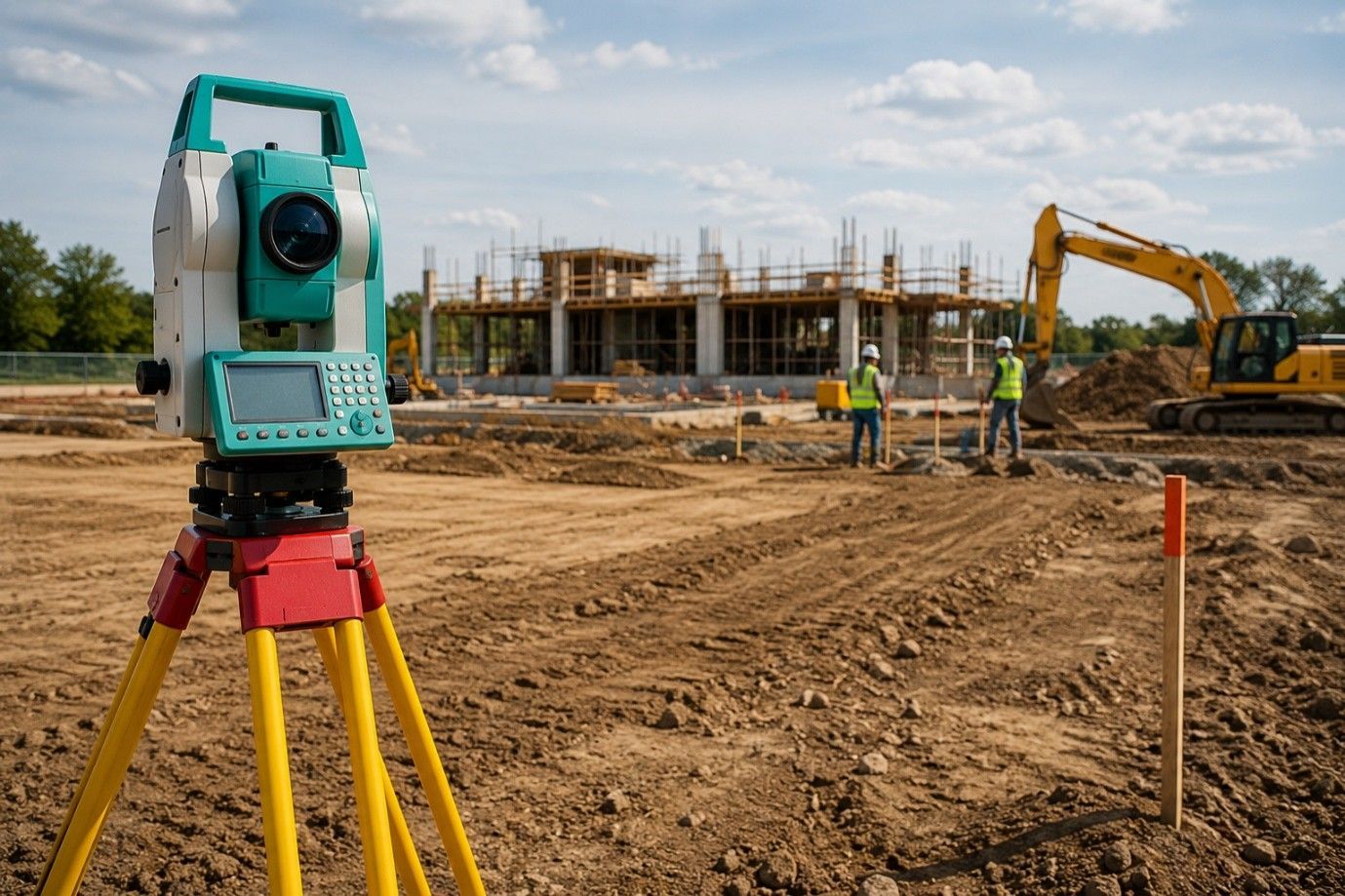
Why Is an As-Built Survey a Legal Record of Completed Construction?
An as-built survey captures the actual state of a project once construction is complete. This survey maps the exact location of structures, utilities, access routes, and drainage systems, confirming what was built matches the approved plans. A professional land surveyor uses precise tools to produce a detailed record that becomes part of the permanent project file. These documents are required by developers, architects, engineers, and permitting bodies for verification and future reference. Every measurement is verified on-site, and any variation from the original design is marked clearly. These differences can include adjusted building footprints, shifted utility paths, or slightly moved access points, all of which must be recorded for the project to meet final approval. With no assumptions made, only field-confirmed data is shown in the finished report.
Verifying Compliance with Approved Plans
As-built drawings help verify that all structural and civil work aligns with original permits. Municipal bodies often require this documentation to close out a permit or initiate further improvements. Without a completed and verified as-built record, a project can face delays in obtaining occupancy or face disputes during resale or financing processes. It provides a layer of assurance for legal and zoning purposes.
Inspectors often compare these final records with initial site plans to ensure the work meets code. Even minor differences, like fence alignment or sidewalk positioning, must reflect what actually exists. In this way, an as-built provides transparency and helps streamline the approval or inspection process.
Supporting Utility Mapping and Access Planning
In projects involving multiple underground or above-ground utility systems, accurate mapping becomes essential. An as-built survey identifies how and where gas, water, electric, sewer, and stormwater systems are placed. This avoids guesswork during future repairs or upgrades. It also helps coordinate access routes for service trucks, emergency vehicles, and future site expansion. The layout ensures no utility overlaps or conflicts exist, keeping everything in its designated corridor.
When emergency repair crews need to respond quickly, these surveys reduce delays by showing exactly where to dig or avoid. Contractors and utility workers rely on this data to reduce mistakes, improve safety, and limit damage to existing infrastructure.
Safeguarding Long-Term Property Records
Over time, the original site plan may become outdated due to small field changes during construction. An as-built record serves as the final, legally recognized version. It offers lasting value to future property owners, title companies, and construction managers. Many cities and counties archive these records for reference in land use decisions and boundary clarification. This legal document can help settle property-related questions years after completion.
Without an accurate as-built, future decisions can be based on outdated or incomplete drawings, which may lead to costly mistakes or permit denials. That’s why builders and owners are encouraged to file these reports with local agencies and keep digital and physical copies for their own records.
Assisting in Dispute Resolution
In property development, changes can occur mid-construction, and records may not be updated. An as-built survey becomes a neutral third-party document that accurately shows what exists. This helps prevent or resolve conflicts over lot boundaries, utility line placement, or building setbacks. If a legal issue arises, these records can serve as evidence in arbitration or court.
It also acts as proof in insurance claims or during property sales. Real estate professionals often request an as-built when determining land value, boundaries, or improvements. It ensures that there are no surprises during land transfers or refinancing processes.
Required for Final Project Closeout
Local authorities and construction inspectors often require as-built documentation before granting a final sign-off. It confirms that all work complies with the issued permits. Without it, a project may be considered incomplete even if all physical work is done. Surveyors compile the as-built with proper symbols, notes, and data that comply with regulatory expectations. This speeds up the approval process and avoids costly corrections later.
A complete record shortens review times and offers peace of mind to all stakeholders, especially those funding or managing the project. It also sets a solid foundation for future work.
Valuable for Renovations or Future Modifications
If property owners plan to build out or remodel years later, they will need an accurate record of what is already in place. The as-built shows structure dimensions, wall placements, driveways, and underground systems. It eliminates the guesswork and prevents damage during renovation. This forward-looking documentation saves both time and money in the long run.
Having this information on hand makes it easier to plan around existing features and avoid project delays. Renovators can focus on their work without re-surveying or uncovering buried mistakes made years before.
Final Recap:
As-built surveys go beyond technical data. They represent the final, approved, and legally recognized version of your site. Choosing the right team to handle it is essential. If you’re searching for a property line survey, or want dependable as-built documentation, our professionals at RealMapInfo LLC deliver accurate results backed by years of on-ground expertise. Our tailored services ensure your completed construction aligns with plans, regulations, and future needs.
Contact RealMapInfo LLC today to schedule your survey and keep your project legally protected and professionally documented.
FAQs:
Q1. What is an as-built survey used for?
An as-built survey documents the final layout of a construction project to match approved site plans.
Q2. Who typically needs an as-built survey?
Builders, engineers, property owners, and local authorities require as-built surveys for legal and planning purposes.
Q3. Is an as-built survey legally required?
In many cases, yes. It’s often mandatory to close permits and obtain certificates of occupancy.
Q4. How does an as-built survey differ from construction plans?
Construction plans show intent; as-built surveys show the actual results after the work is done.
Q5. Can as-built surveys help with future renovations?
Yes, they provide exact measurements and placements, making renovations easier and reducing costly mistakes.


Share On: