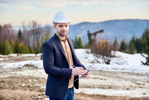
Are Professional Survey Services Necessary for New Construction Sites?
Starting a new construction project is more than just building. Every house, driveway, or pool needs careful planning. Professional survey services help by giving exact measurements, property boundaries, and site checks. Without a proper survey, construction can run into mistakes, legal problems, and delays. Surveys give property owners and builders a clear starting point and help avoid costly surprises. They are a key step in turning ideas into a successful, safe, and well-planned project.
Why Surveys Are Important for New Construction
A survey is not just paperwork; it is the first step for accuracy. Surveyors mark property lines, measure the land, and check for any obstacles. For new construction, this makes sure foundations are placed correctly and buildings fit inside legal boundaries. Using old maps or guesses can lead to disputes with neighbors or breaking building rules, which makes professional surveys necessary. Surveys also provide detailed data that helps architects and engineers design buildings that fit the land perfectly. They allow for proper planning of driveways, gardens, pools, and any other structures.
Stop Property Boundary Problems
Property lines are not always clear. Even a small mistake can cost a lot of money and time. Professional survey services give exact boundaries and clear documents. Builders and owners can start work safely, knowing their project is inside legal limits. Accurate surveys protect property owners from legal issues later. If someone builds on the wrong part of the land, correcting the mistake can be very costly. A survey ensures everyone knows exactly where the property begins and ends.
Save Money and Avoid Mistakes
Placing a building or utilities in the wrong spot can be very expensive. Surveys show the best locations for foundations, water pipes, and electricity lines. By knowing the land’s slope and underground features, builders avoid mistakes, save money, and finish work faster. Surveys also help plan roads, parking areas, and walkways in a way that prevents future problems. For example, avoiding low spots where water can collect prevents damage to buildings and reduces maintenance costs.
Plan Utilities and Land Properly
Surveys do more than mark boundaries. Professionals check for slopes, drainage, and obstacles for water, electricity, and roads. Without this data, construction can face problems like water pooling, weak structures, or extra costs later. Proper planning of utilities ensures homes and buildings are safe, efficient, and functional. It also reduces the chance of unexpected interruptions during construction.
How Technology Helps Surveys
Modern surveys use drones, GPS, and 3D scanning. These tools give accurate measurements quickly. Builders get precise information about slopes, foundations, and land layout. Technology makes surveys faster, safer, and much more accurate than older methods. Using drones, surveyors can check large areas in a short time and capture data that is hard to see from the ground. GPS ensures every point on the property is measured correctly, helping avoid mistakes.
Prepare for Future Changes
A survey is useful for the future, too. It helps if you want to add buildings, renovate, or sell the property. Accurate survey reports also make it easier to get permits and approvals later. For example, if someone wants to build a deck, garage, or pool years after the first construction, survey records guide where and how it can be done legally. Surveys make future planning easier and reduce the risk of disputes or delays.
Build Trust and Avoid Disagreements
Survey reports show every part of the site clearly. Contractors, architects, and owners can check the report to make sure work follows the plan. Surveys create trust and reduce conflicts, so everyone knows the project is done the right way. For example, if there is any question about property lines or the placement of structures, the survey report provides clear evidence. This reduces stress and ensures smooth communication between all parties involved.
Closing Note:
At RealMapInfo LLC, we offer accurate professional survey services for your construction projects. From checking boundaries to preparing detailed site maps, we give the information you need to make the right decisions. If you are building a pool, we also provide documents for a pool permit plot plan to meet local rules. Work with us to start your project safely, legally, and without stress. Partnering with RealMapInfo LLC ensures your construction project is done correctly from day one. Our team helps with everything from the initial survey to final approvals, giving you confidence in every step. Using our services reduces risk, avoids costly mistakes, and saves time. We focus on accuracy, speed, and clarity so builders and owners can move forward without worry.
Contact RealMapInfo LLC today to schedule your survey and get exact site data for a smooth construction project. Let us help make your construction plans a reality, while keeping everything compliant, safe, and stress-free.
FAQs:
1. What are professional survey services?
Professional survey services measure land, map boundaries, and provide reports for safe and legal construction planning.
2. Why do new construction sites need surveys?
Surveys prevent legal issues, ensure correct placement, and help avoid costly construction mistakes.
3. How does a survey help with utilities and drainage?
Surveys provide information about slopes, drainage, and underground features for proper utility planning.
4. Can surveys help with future property changes?
Yes, surveys provide accurate records that guide renovations, expansions, and future permits.
5. Do surveys reduce construction risks?
Accurate surveys prevent errors, save costs, and ensure projects follow legal and structural requirements.


Share On: