Need Verified Property Lines Fast? Why Boundary Surveys Are the Solution
For homeowners, builders, and property buyers, knowing exact property lines is very important. A property boundary survey gives clear measurements to show exactly where your land ends. Without a survey, building, fencing, or selling land can cause disputes, delays, or extra costs. A professional survey protects your property, ensures rules are followed, and gives you peace of mind. Boundary surveys are more than simple measurements: they are legal records that define property ownership and prevent future problems. Having verified property lines also helps with planning landscaping, adding new structures, or installing driveways. You can avoid guessing where boundaries are and prevent accidental mistakes that could cause trouble with neighbors or local authorities.
Why Property Boundaries Can Be Confusing
Even people who own land for years may not know the exact edges. Old records, unclear markers, or mistakes in past surveys can make boundaries confusing. A professional survey shows exactly where your property begins and ends.
This helps prevent accidentally using someone else’s land and avoids arguments with neighbors. Builders also rely on surveys to place buildings, driveways, or utilities in the right spot. Clear boundaries make planning easier and safer.
Some properties may have irregular shapes or overlapping old survey records, which makes it hard to know the true limits. By having a boundary survey, owners get certainty and can plan confidently without second-guessing measurements.
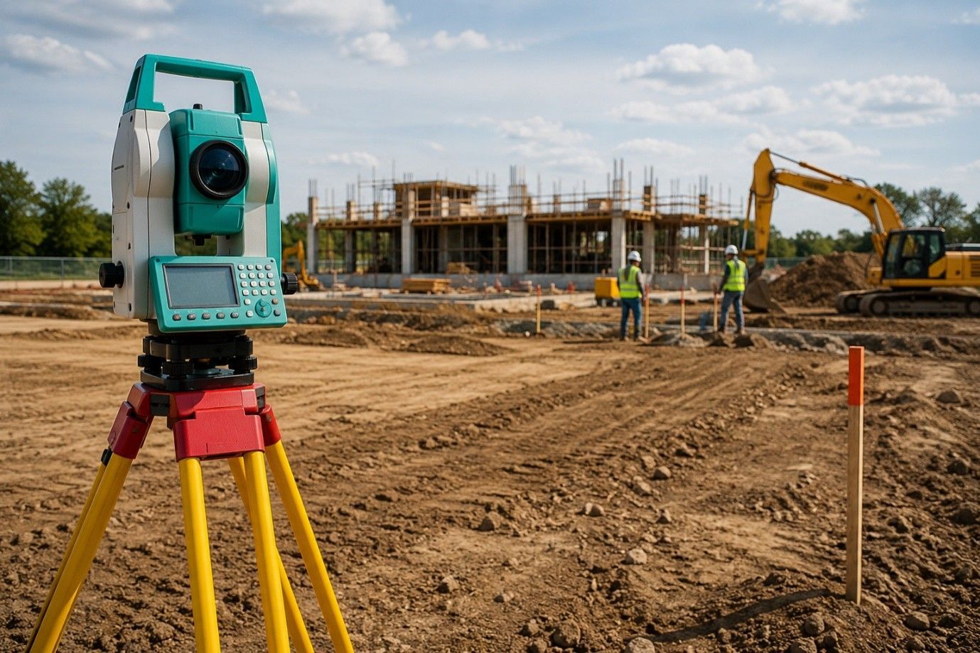
Tools and Methods That Give Accurate Results
Surveyors use modern tools to make sure measurements are correct. GPS devices, laser measuring tools, and total stations help map property lines precisely. The data is used to create detailed maps that show boundaries, slopes, and important points on the land.
For tricky or uneven land, surveyors use extra measuring techniques to make sure nothing is missed. These steps make sure property limits are accurate and legally correct.
These tools not only improve accuracy but also save time. What once took days of manual measurement can now be done in hours, giving property owners verified results quickly.
Avoiding Disagreements and Legal Problems
Disagreements over land are common. Fences, driveways, or even gardens can accidentally go over a property line. Boundary surveys provide a clear, official record that is recognized by local authorities to prevent disputes.
This is very useful when selling or buying land. Buyers can trust the property lines, and sellers avoid problems that could stop a sale.
Having a survey also provides documentation if disputes arise in the future. Courts and local authorities rely on professional surveys as proof of property boundaries, which helps resolve conflicts quickly and fairly.
Guiding Construction and Building Projects
Before building, a boundary survey shows where houses and other structures can be safely placed. Builders use surveys to follow the rules and avoid rework or fines.
Homeowners planning extensions or renovations also benefit. Surveys guide contractors to build safely within property limits and make the best use of space.
For developers working on larger projects, surveys help in planning multiple buildings, roads, and utilities. They reduce errors and ensure projects follow legal setbacks and zoning rules, which keeps work smooth and efficient.
Easy-to-Read Visual Maps
Survey results are usually shown as clear maps. These maps show property lines, access paths, and other important features. Homeowners, builders, and officials can see the same accurate information.
Having a visual map reduces mistakes and keeps projects on track. It also helps homeowners plan fences, gardens, or future additions.
These maps are helpful for anyone involved in the project. Even people with no technical knowledge can understand the layout, making communication between contractors, designers, and owners much easier.
Records That Help in the Future
A boundary survey becomes part of the official property record. It is useful for future sales, loans, or new construction. Clear records add value to your property and give buyers confidence.
Developers benefit from surveys when managing multiple properties. Surveys reduce mistakes and save time across different projects.
Future improvements, like adding a pool, driveway, or garden structure, are easier when property lines are clearly documented. You won’t have to redo work or guess where boundaries lie, which saves time and money.
Save Money and Avoid Stress
Investing in a survey can save money later. It prevents disputes, construction mistakes, and delays. Property owners can work with confidence, knowing their land is measured correctly.
Even small mistakes in boundaries can be costly. A professional survey makes sure all decisions are based on accurate information.
A survey also helps in planning budgets for construction or landscaping, avoiding unexpected costs caused by boundary errors. It is an upfront investment that protects both money and peace of mind.
Ending Note:
At RealMapInfo LLC, we provide accurate and reliable property line surveys. Whether you are building, buying, or selling land, our team delivers precise measurements and easy-to-read maps to protect your property. If you want verified property lines quickly, our experts are ready to help. Contact RealMapInfo LLC today to secure your property and move forward with confidence. Our services not only save time and money but also make planning and construction simpler. With clear, verified boundaries, your property is safe, legal, and ready for any project.
FAQs:
1. What is a property boundary survey?
It is a professional survey that measures land to define the exact property limits.
2. Why do I need a boundary survey?
It prevents disputes, guides construction, and ensures your property lines are legally accurate.
3. How is a property boundary survey done?
Surveyors use tools like GPS, lasers, and total stations to map and record exact boundaries.
4. Can a boundary survey help with construction planning?
Yes, it ensures structures are built within legal limits and avoids fines or rework.
5. Are boundary surveys important when selling land?
Absolutely, they provide verified records that give buyers confidence and reduce potential conflicts.


Share On: