What Are Property Survey Measurements and Why Are They Important?

November 15, 2024

Understanding your property is crucial, especially if you plan to buy, sell, or develop land. Property survey measurements provide the essential details you need to make informed decisions. But what exactly are these measurements, and why do they matter? Let’s explore their significance and how they impact property ownership.


Defining Property Survey Measurements

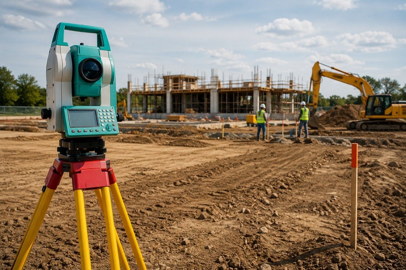
Property   survey measurements involve precise measurements of land boundaries, dimensions, and features. This process includes establishing property lines, measuring distances, and identifying structures on the property. Surveyors use special tools and techniques, such as GPS and total stations, to gather accurate data. These measurements form the basis for creating detailed property surveys that show everything from boundary lines to existing structures and easements.


Why Accurate Measurements Matter

Accuracy in property survey measurements is vital for many reasons. First, precise measurements ensure clear and well-defined property lines. This clarity helps avoid disputes with neighbors about where one property ends and another begins. If property lines are incorrectly marked, it could lead to legal issues and costly alterations. Having accurate measurements allows property owners to know exactly what they are buying or selling, ensuring a fair transaction.


The Role of Property Survey Measurements in Real Estate Transactions

In real estate, property survey measurements play a key role. When buying or selling property, having an accurate survey is often required. It provides essential information for buyers, helping them understand what they are getting. A property survey can reveal issues such as encroachments or zoning restrictions that could affect future plans. For sellers, an updated survey can speed up the selling process by providing potential buyers with the information they need to make informed decisions.


The Importance of Compliance with Local Regulations

Every local government has specific zoning laws and regulations that property owners must follow. Property survey measurements help ensure compliance with these rules. By accurately measuring the property, surveyors can determine if structures meet local setbacks, height restrictions, and other zoning requirements. This compliance helps prevent future legal issues, fines, or forced modifications to existing structures. Property survey measurements are, therefore, a necessary step in any development or renovation project.


How Survey Measurements Aid in Property Development

For those looking to develop or renovate property, accurate survey measurements are essential. They help in planning new constructions, landscaping, and other improvements. Knowing the exact dimensions of your land allows you to maximize your space efficiently. Whether you are building a new home, adding a fence, or creating a garden, having the right measurements ensures that your project fits within your property boundaries and adheres to local regulations.


Wrap Up:

Property survey measurements are essential for property ownership and development. They clarify property lines, ensure compliance with local laws, and support informed real estate transactions. To navigate these complexities, consulting a local surveyor is wise. These professionals provide the expertise needed to obtain accurate measurements and create comprehensive surveys, helping you avoid potential issues down the line. If you’re looking to make confident property decisions, consider reaching out to a knowledgeable surveyor. Companies like RealMapInfo LLC offer specialized services that can help you understand your property better and guide you through the process efficiently.


September 3, 2025
Building a shed may seem simple, but the approval process depends heavily on one detail; the shed permit plot plan . This document shows the exact placement of the shed, its size, and its relation to property boundaries. If the approved plan does not match the shed’s real location, serious problems can arise. Homeowners often underestimate the impact of these mismatches, but local authorities treat them as compliance issues that can lead to costly setbacks. Why Accuracy Matters in Permit Applications A plot plan is more than just a drawing. It is a legal reference used by zoning boards and inspection officers to confirm that a structure follows codes and distance requirements. Even a small difference between the plan and the actual site can raise red flags during inspections. This is because municipalities rely on these documents to protect neighboring properties and to keep building activity aligned with land use rules. Accuracy also protects property owners. Without precise documentation, you may unintentionally violate zoning ordinances. For example, a shed placed closer to the neighbor’s fence than allowed can trigger disputes and legal action. Once the shed is in place, fixing such mistakes is not only time-consuming but can also be financially draining. Common Mistakes That Lead to Plan Mismatches Several errors can cause the submitted plot plan to differ from the shed’s real position: • Misreading property lines or survey data • Using outdated measurements instead of recent surveys • Placing the shed closer to fences, easements, or utilities than allowed • Changing the shed size after approval without updating the plan • Skipping professional help and relying on rough sketches instead of accurate plans These issues often come to light only during a final inspection, creating stress and unnecessary delays. For homeowners, realizing that the shed must be shifted a few feet after it is already built can feel like starting the project all over again. Consequences of a Non-Matching Plot Plan If your shed does not align with the approved plan, the municipality may issue a violation notice. Depending on the severity, homeowners might face: • Stop-work orders until corrections are made • Fines for non-compliance with local codes • Requirements to move or even remove the shed entirely • Delays in obtaining final approval and completion certificates These setbacks not only impact the project timeline but can also affect financing and insurance if the shed is considered non-compliant. A simple oversight in the planning stage can therefore have lasting effects on the value and usability of the property. How Inspectors Handle Discrepancies Inspectors are trained to look closely at shed placement compared to the approved documents. They measure setbacks from property lines, check distances from existing structures, and compare these numbers with what is recorded in the file. If they notice inconsistencies, they will flag the project and request updated documents. For minor adjustments, revised paperwork may be enough. However, for major deviations—such as placing a shed in a restricted setback zone; the process becomes more complicated. You may need a fresh survey, a new submission, and another round of approval. This means paying fees again and waiting for city review before moving forward. Steps to Prevent Problems Before They Start Preventing mismatches saves both time and money. Key steps include: • Getting a current survey before starting construction • Double-checking local setback requirements and height limits • Consulting professionals to draft the plot plan accurately • Avoiding design changes after approval unless the plan is officially updated • Keeping open communication with your permitting office during the process Following these practices ensures that your shed meets both legal and practical requirements. Homeowners who take preventive steps often finish their projects on time, with fewer headaches and no unexpected expenses. Real-Life Impact of Inaccurate Plot Plans Consider a property owner who submits a plan showing their shed six feet from the boundary line, but the actual shed ends up only three feet away. During inspection, the error is caught. The local authority issues a violation notice, requiring either relocation of the shed or a costly variance application. In many cases, relocation means dismantling the structure and rebuilding it in the approved position. This doubles expenses and adds months of frustration. Such examples highlight why investing in accuracy at the planning stage is far cheaper than fixing problems after construction. The Role of Professional Assistance For many property owners, preparing a shed permit plot plan can feel overwhelming. Working with mapping and survey experts helps avoid errors that trigger compliance problems. Professional services provide precise measurements and legally acceptable documents that pass inspection without delays. Survey professionals also help interpret zoning rules, which often differ from one municipality to another. By hiring experts, you not only reduce the chance of error but also gain peace of mind knowing that your project is supported by documents that meet regulatory standards. Closing Note: If your shed permit plot plan does not match the actual site, it can lead to serious penalties, project delays, or even removal orders. Ensuring that your documentation is accurate from the start is the best way to stay compliant. For those wondering how to get a plot plan that meets legal standards and avoids future disputes, our team at RealMapInfo LLC provides professional land survey services tailored for shed projects and other property needs. We specialize in delivering accurate, approved, and hassle-free solutions that save homeowners time and money. With our expertise, you can be confident that your project is in line with zoning codes and inspection requirements. FAQs: Q1. Why is a shed permit plot plan required? It ensures the shed location meets zoning laws and property setback requirements. Q2. What happens if my shed doesn’t match the approved plot plan? You may face fines, stop-work orders, or be required to move or remove the shed. Q3. Can I update my plot plan after approval? Yes, but you must resubmit revised documents to the permitting office before making changes. Q4. How do inspectors check shed placement? They measure distances from property lines and compare them with the approved plot plan. Q5. How can I avoid shed permit problems? Hire a survey professional, use accurate measurements, and confirm setbacks before building.
as-built survey
August 12, 2025
Need final approval or resolving boundary issues? Our licensed surveyors deliver precise as-built and property line surveys for permits, construction, and legal compliance.
Building Permit Plot Plan
August 9, 2025
Need a plot plan for your building permit? Our local land surveyors create accurate, code-compliant plans to get your project approved faster. Trusted Texas experts.
Land Surveying Services
August 6, 2025
Need a residential boundary survey before dividing your land? Our expert land surveyors ensure legal compliance, precise layouts & faster approvals. Start your project today.
Property Surveyors In My Area, Local Surveyors In My Area
By 7003338036 August 4, 2025
Need reliable property surveyors near you? Our local experts deliver accurate land surveys, boundary checks, and zoning reports to protect your investment. Book now.
land encroachment
Property Boundary Lines
July 11, 2025
Suspect land encroachment? Get expert help to confirm property boundary lines. Avoid disputes with accurate surveys from licensed professionals you can trust.
survey property lines
shed permit plot plan
July 5, 2025
Need to survey property lines or get a shed permit plot plan? Our licensed team provides accurate Property Line & Residential Land Surveys you can trust.
Land Surveyors In My Area
Property Boundary Survey
July 4, 2025
Find reliable land surveyors in your area for a Property Line Survey or Residential Land Survey. Confirm boundaries, zoning & access before any real estate deal.
land surveying services
June 20, 2025
Are you looking for land surveying services? To learn about this important service, read on or contact RealMapInfo LLC today!
Professional Property Surveyors For Property Lines
By 7003338036 June 8, 2025
Discover how Professional Property Surveyors can help define your property lines accurately. Ensure legal clarity and avoid disputes with expert surveys.